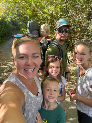
Written by Holly of All Weather Adventuring. With cold and flu season upon us, it is more important than ever to get outside for some fresh air! I posted this reel last week on Instagram highlighting some of the many health benefits of getting fresh air. This Trail Tuesday, we’re gunna talk about the best Military Reserve hike with kids.
Bundling up and getting outside is so good for everyone’s mental and physical health! I know, I know… sometimes it can be harder to motivate kids (or ourselves) to get outside when it’s cold. But with all those health benefits, it’s worth the effort! For extra motivation for the kids, try getting one of the adventure guide kits I create! It is a great resource to motivate and excite kids to get outside and look for different animals or animal tracks in these colder months. Searching for animal tracks in the snow is one of my family’s favorite winter activities.
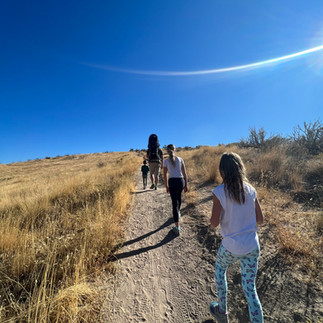
For this Trail Tuesday. I want to tell you about my favorite loop at the Military Reserve. With so many trails to explore there, it can get super confusing, so I have created this fun hiking guide to help you along the way. I call it “Ridge to Ridge” and it features Eagle Ridge and Central Ridge, but as you will see, it can be shortened and used multiple days/ways! This way you can make this Military Reserve hike with kids as easy as possible.

“Ridge to Ridge” Hike at the Military Reserve
- Park at the Cottonwood Creek trailhead off Mountain Cove Road, not too far past the bike park. There is a dirt parking area on the right side of the road.
- Pro-tip: There is not a bathroom at this trailhead, so use the one at the bike park area if needed.
- The entire hike is about 3 miles long with 500 feet of elevation gain. It can be shortened to two separate 1.5 mile loops with around 150-200 feet of elevation gain for the Eagle Ridge Loop and 300-350 feet of elevation gain for the Central Ridge Loop.
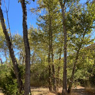
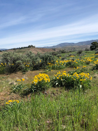
- Keep in mind that Eagle Ridge Trail is a good “all weather trail” option and can be used pretty much year round. Central Ridge Trail gets very muddy so if it has rained/snowed, it is best to avoid that section. More detailed info and current condition updates can be found on Ridge to Rivers website. Let’s all be responsible and take great care of our trail system!
Hike Directions
- Go through the gate and walk straight for about 100 feet on Toll Road Trail before taking the first right onto Cottonwood Creek Trail.
- After following the creek, there is a sign pointing up to Eagle Ridge Trail. Follow this trail and climb up the wooden stairs.
- At the top of the stairs, enjoy a great view of downtown Boise. Take a left on the paved service road and follow as it winds up the hill.
- Turn left onto Eagle Ridge Loop and find the “Eagle’s Nest Picnic Spot”. I named it this for my kids’ enjoyment and we usually like to take a break and have a snack here!
- At the next sign, stay to the left to continue along Eagle Ridge Loop. Continue straight on Eagle Ridge Loop, walking past the Cottonwood Creek “hiker only” trail.
- At the next junction, join back up with Eagle Ridge Trail as you descend. This is such a fun section for kids (and adults) to run down!
- At the bottom of the hill, you will come to a “T” in the trail. Turn right onto Cottonwood Creek Trail and walk along the path over the creek.
- At the next fork, if little hikers are feeling tired, there is the option to shorten the hike by taking a left to follow Toll Road Trail for a half mile back to the parking area. This is also a good idea if trail conditions are muddy and you can’t continue on Central Ridge.
- To continue the hike, follow Ridge Crest Trail as it winds uphill slowly and steadily for 0.6 miles. This sandy section can be a fun spot to look at the different footprints and animal tracks using the Adventure Guide Kit! It is also a bit of a grind, so take plenty of breaks and use treats to encourage little hikers up the hill! Check out my post on IG for some of my best tips and tricks for hiking with kids.
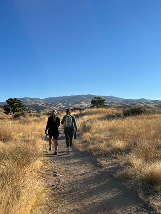
- At the top of the hill, take a left onto Central Ridge Trail. Continue straight past the signs and Ridge Crest trail to an awesome overlook spot on the left side of the trail, perfect for taking in the panoramic views of downtown Boise, the foothills, and Bogus Basin.
- Continue on Central Ridge Trail for about a half mile, passing the first turnoff for Central Ridge Spurs. There is a second turnoff for Central Ridge Spurs. Take this second turn to the right and then take another right to stay on Central Ridge Spurs trail.
- There is a bathroom by a parking area that you can see from here if it is needed!
- Take a left onto Freestone Creek and enjoy walking along this seasonal creek. Continue straight onto Central Ridge Spurs.
- Finally, take a right onto Toll Road Trail and walk the 100 feet back to the parking area.
Please always feel free to reach out to me on IG with any questions you have and let me know if you try this Military Reserve hike with kids! HAPPY HIKING! –Holly